Pete Scifres, PPSA, GPSA
September 2023 - Joshua Flats
Original
About the Image(s)
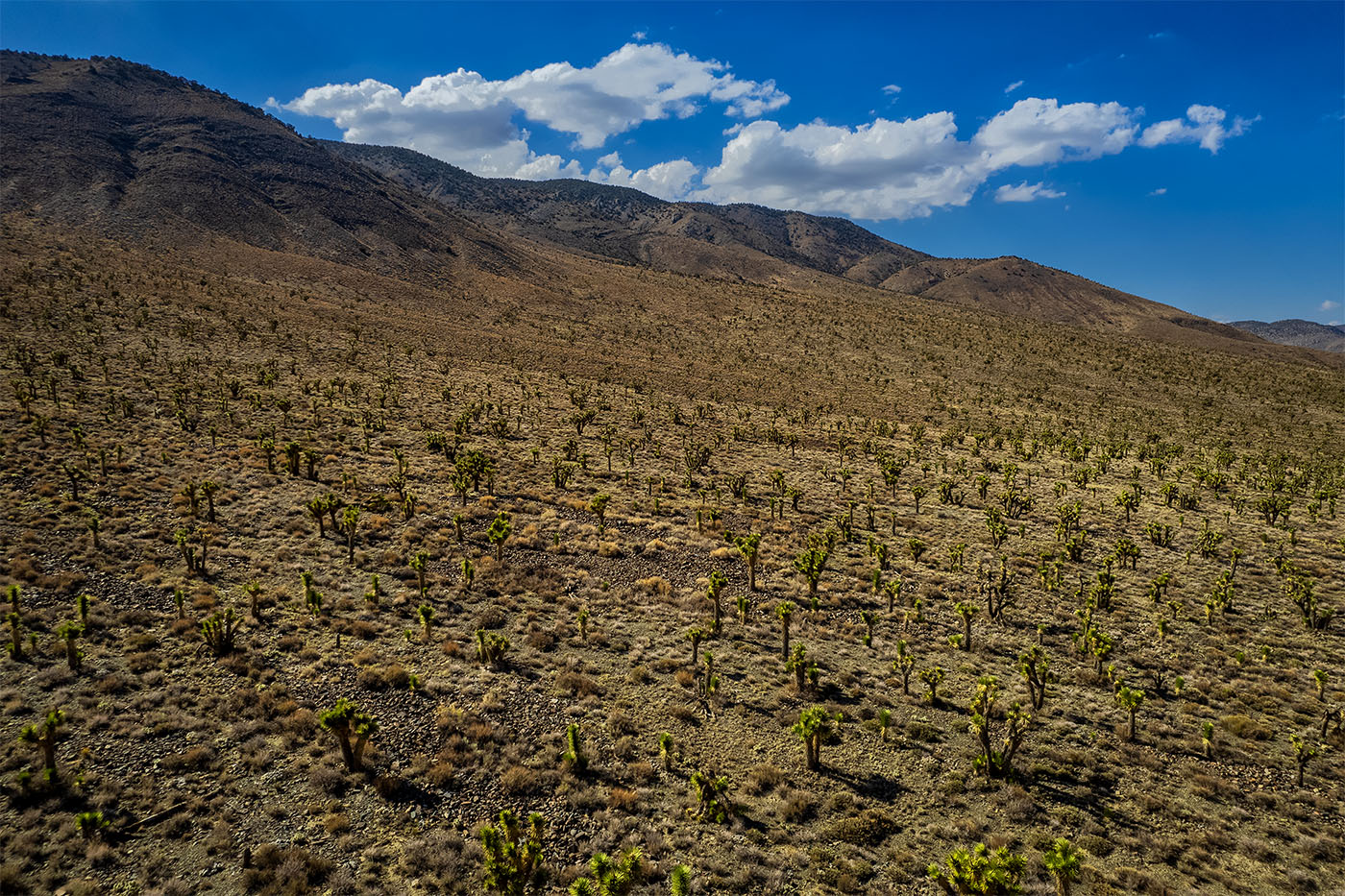
I have long been fascinated by this spot -- so-called Joshua Flats -- located on the remote road between the Eastern sierras town of Big Pine and the Eureka Sand Dunes area of Death Valley National Park. As far as I know it is the densest concentration of Joshua Trees outside of Joshua Tree National Park and the Mojave National Scenic Preserve. It appears with no warning as you begin to descend to the Eureka Valley and goes on for hundreds of yards on the north side of the road, running up a moderate slope to the ridgeline.
I had been interested in using the drone to photograph it for a while but thought it was actually inside DVNP. One day in an idle moment I looked at a map more closely and realized the park boundary in this area runs right along the road and while the south side is in the park. the north side is outside of it.
I was in the area last August and drove over there and flew the drone, launching from the road. The topography is such that the sun dropped off of the trees relatively early and the light was still pretty harsh and contrasty. I did have some nice puffy clouds in the just the right spot. I needed all five exposures to get a blend with the dark areas reasonably bright and the clouds not blown out.
I positioned the drone so the tree shadows from the sidelight were as prominent as possible. I am low, perhaps 50 ft up.
The topography is such that I believe returning close to the winter solstice will result in later light on the trees and I plan to try that sometime. I think it could be a very nice image.
This round’s discussion is now closed!
5 comments posted
Like Janos, I wish there was something in the photo to help me judge the size of the trees and to focus my attention on. When I first look at your image, I eyes first go to the sky and clouds. Then at some point my attention shifts to the trees, which is probably not what you intended. Posted: 09/18/2023 00:57:42